
Finding Hawaii County Residents
Begin with the fact already in hand. A present-day street address belongs in the Hawaii County Tax & Revenue search and Planning GIS. A person’s name may fit the tax roll, eCourt Kōkua, a professional license search, a business filing, or a historical directory. A deed question belongs with the state Bureau of Conveyances, known as BOC. The County Clerk is the right office for County Council records, but it does not issue vital certificates or maintain the deed index. Hawaii has no separate incorporated city governments, so a search for a Hilo or Kona city clerk often points to the wrong custodian.
Official records describe roles, not a complete population. A tax record may name an owner or mailing recipient who lives elsewhere. A deed names parties to an instrument. A court index names parties in a case. Voter data has strict limits, and vital certificates require legal eligibility. Renters, family members, and people who receive no public-facing record may not appear at all. Treat each match as a lead, label its role and date, then compare another source before deciding that two entries describe the same person.
- Search the county property roll by address, parcel, street, or mailing name.
- Use Planning GIS to confirm the TMK and physical parcel.
- Check BOC instruments or public court cases when the question calls for them.
- Consult directories, maps, and archives for a past household.
- Send a focused UIPA request to the proper custodian when no portal supplies the record.
Hawaii County Records Desks
The resident trail crosses county and state lines of responsibility. Real Property Tax maintains current parcel and tax data. The Hawaii State Bureau of Conveyances records deeds, mortgages, liens, releases, and other land instruments statewide. Hawaii County Elections handles local voter services, while the state OLVR portal lets a voter manage or confirm only that voter’s own record. Court cases belong to the Hawaii State Judiciary’s Third Circuit. For a full address workflow, continue to the Hawaii County street directory.
Hawaii Bureau of Conveyances
1151 Punchbowl Street, Room 120
Honolulu, HI 96813
(808) 587-0147
Hawaii County Real Property Tax
101 Pauahi Street, Suite 4
Hilo, HI 96720
(808) 961-8201
Search Hawaii Parcels Five Ways
The current Tax & Revenue property search offers five useful routes: PIDN, MAP/Parcel, location address, street name, and mailing name. PIDN means Property Identification Number and requires an exact match. The other modes accept partial text, which helps when a name contains a middle initial or a road uses a longer official form. Results show the Property ID Number, Parcel Number, Mailing Name, Location, and Amount Due. The portal is a current starting point, not a full history of every past owner.
| Search field | Best use | Main caution |
|---|---|---|
| PIDN | One exact tax account | Inactive PIDNs may not display |
| MAP/Parcel | A known parcel reference | Confirm the TMK format |
| Location address | The physical site | Not proof of occupancy |
| Street name | Several parcels on one road | Aliases may differ |
| Mailing name | An owner or tax recipient | May be a trust, firm, or remote owner |
The official search screen shows how these modes are separated.
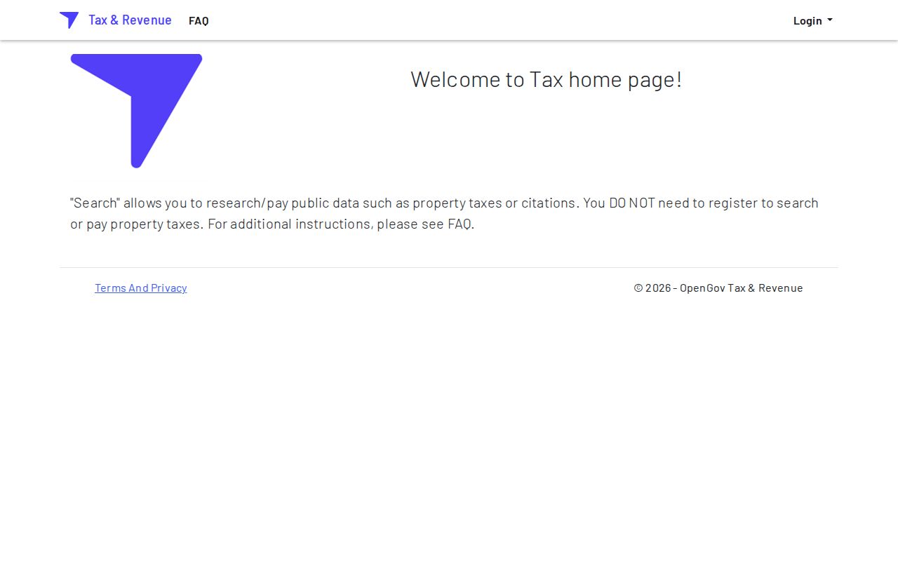
That field choice is important because a broad street search and an exact PIDN search answer different questions.
Mailing Names Need Verification
A mailing name is the person or entity selected to receive a tax notice. It may be the occupant, but the record does not promise that. The recipient could be an owner living elsewhere, a trustee, a business, an estate, an agent, or another fiduciary. The Location field is the situs, meaning the physical place of the parcel. Neither field alone identifies everyone who lives there.
Record roles are not interchangeable
Owner: the party shown by property or deed evidence. Mailing party: the tax recipient. Occupant: a person who actually lives at the address. Applicant: the person or firm named on a permit. Preserve the label that the source uses.
Compare the tax result with the parcel map, a deed instrument, and a dated directory entry when the purpose is family history or a property inquiry. If the sources disagree, record the mismatch rather than choosing the most familiar name. Rural routes, PO boxes, trusts, and changed street labels often explain why the records do not line up.
TMK Connects Island Records
The Tax Map Key, or TMK, is the strongest cross-reference between a Hawaii County parcel, the Planning map, tax data, permits, and recorded land documents. Planning’s GIS guide contains a local quirk: when a map search rejects a full TMK, omit the leading island-zone digit in the format the map requests. That change affects the search string, not the legal identity of the parcel.
Use the County Planning Web Map to locate the parcel and examine zoning, land-use, SMA, General Plan, and nearby-parcel layers. A parcel is a mapped unit of land, while a plat is a recorded map that lays out lots or subdivisions. GIS is useful operational evidence, but it is not a survey and does not establish a legal boundary. Record the source date and TMK before moving to the deed index.
Current Hawaii County Name Sources
There is no official master list of Hawaii County residents. Several current public sources expose narrower groups, each for a stated government purpose. The safest method is to ask what role the source records and whether the person supplied enough detail to distinguish the right individual. The Hawaii County resident lookup workflow develops that name-first method.
| Source | Who It Lists | Keeper | Access |
|---|---|---|---|
| Tax & Revenue roll | Owners or mailing parties | Hawaii County RPT | Free current portal |
| Public voter list | Name, precinct, status | County Elections | Limited by Hawaii law |
| BOC index | Parties to recorded instruments | State BOC | Online from 1976 |
| eCourt Kōkua | Parties in public cases | State Judiciary | Free metadata; some documents cost |
| PVL search | Licensed professionals | State DCCA | Free status search |
OLVR is not a public name search. It lets a voter register, update, or confirm the voter’s own record. The separate public election list is limited to name, district or precinct, and voter status under HRS §§11-97 and 11-14; residence address, birth date, identifiers, phone, email, and signature from the affidavit are restricted. Likewise, a license result proves a license name and status, not where a person lives.
Read Hawaii Deed Indexes
The Bureau of Conveyances is Hawaii’s statewide recorder. Its online index covers instruments recorded from January 1, 1976 forward. Search concepts include grantor and grantee names, document number, and TMK. A grantor transfers or grants an interest; a grantee receives it. Results may distinguish the Regular System from Land Court and can show instrument type, recording date, document number, book and page, land-court certificate, and sale information.
Do not treat every BOC hit as a change of owner. The office uses codes such as D for deed, AD for apartment deed, M for mortgage, R for release, NL for notice of lien, and LCO for land-court order. Read the instrument type and parties before drawing a conclusion. Earlier records require reference-room research or a written request. Post-1991 written-search copies generally carry a per-page charge plus processing; pre-1992 requests use a different flat search fee and processing charge. Confirm the current schedule before ordering.
The BOC document-search entry point separates the recorded land trail from county tax data.
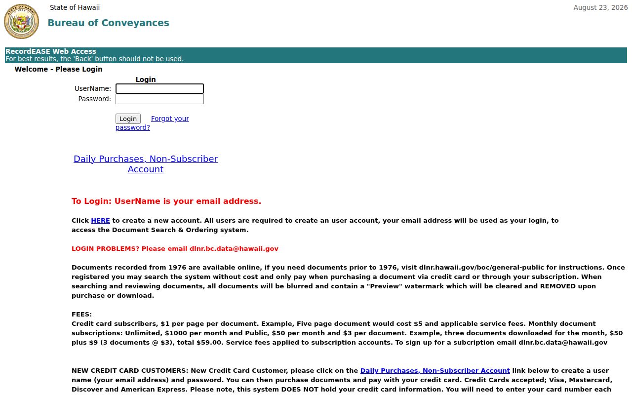
Carry the exact name spelling, TMK, instrument number, date, and system label into the next search.
Check Third Circuit Names
eCourt Kōkua provides statewide public case and party searching, including Hawaii County matters in the Third Circuit. Search fields can be narrowed by a person or business name, filing dates, case type, and other case identifiers. Results may show the party role, case number, court, filing date, status, events, and public documents. A docket is the dated list of filings and events in a case; a disposition is the outcome or present resolution.
Online coverage and document availability vary by case type. Confidential, sealed, and juvenile matters do not become public merely because a name is searched. When the portal is incomplete, public terminals at Hale Kaulike in Hilo and the Keahuolū Courthouse in Kona are available during the Judiciary’s listed access hours. Older files may be off-site and require a staff request. Free metadata is not the same as a certified copy, and document or certification charges may apply.
Vital Records Stay Restricted
Hawaii birth, death, marriage, and civil-union certificates are not open resident indexes. HRS §338-18 requires a direct and tangible interest or another listed legal basis. The online order asks for the event, the applicant’s relationship, identity evidence, delivery information, and payment. Genealogy copies generally become available only for records older than 115 years, which places the routine threshold before 1921 in 2026.
A current procedural change matters: the Department of Health stopped maintaining divorce records on February 1, 2026. Request a divorce decree from the court that granted it. The state’s typical online vital-record timing is four to six weeks, and fees vary by channel. Never use a paid order as the first step if a directory, cemetery record, probate file, or archive index can answer the historical question without seeking a restricted certificate.
Licenses and Entities Confirm Roles
The DCCA Professional and Vocational Licensing search can confirm a regulated professional’s name, license number, type, and current status. Hawaii Business Express can connect a person to an entity or trade name in a filed role. Its new portal became effective July 6, 2026, so older instructions may lead to a retired interface. Unclaimed Property offers another free name search, but a match only signals property held for a claimant; it is not an address directory.
Official indexes
Identify a stated role, custodian, date, and record number. Coverage and privacy limits are published, and certified copies come from the agency.
Commercial people search
May combine stale or mismatched data without showing its source. Results can cost money and should never replace verification with the actual custodian.
The BOC public-search guidance explains access to the recorded-document index and older records.
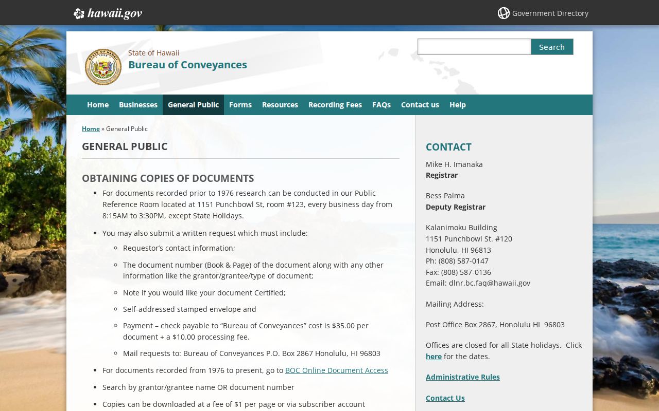
Role labels keep a business manager, property grantee, and resident from being merged into one unsupported identity.
Request Hawaii County Records
Hawaii’s Uniform Information Practices Act (Modified), HRS chapter 92F, opens non-exempt government records to any person. A useful request names the custodian, describes the record type, gives a tight date range, and includes the address, TMK, case number, document number, or other known identifier. Ask for an electronic copy when that format will work. An agency need not create a new list that it does not already keep, and privacy or another statute may require redaction or withholding.
Ordinary requests generally receive a response or status notice within about ten business days. Extenuating circumstances can extend the process, commonly to twenty business days with notice. Search, review, segregation, and copying charges may apply; the OIP manual describes a general first-$30 fee waiver and a larger waiver for qualifying public-interest requests. Start with the County WebLink repository because Council records, ordinances, cemetery material, permits, and reports may already be downloadable. A failed text search does not prove the County lacks the record.
Write to the actual keeper. County Clerk handles Council material; Planning and Real Property Tax handle parcel records; BOC holds recorded land instruments; the Judiciary holds cases; and Health holds eligible vital certificates.
Privacy Can Explain Gaps
A missing name is not proof that a person never lived in Hawaii County. The Hawaii Address Confidentiality Program under HRS chapter 801G provides eligible survivors with a substitute address and mail forwarding. Chapter 92H protects some personal information belonging to certain public servants. Voter affidavits, motor-vehicle data, vital records, sealed court matters, juvenile information, and protected law-enforcement material also have their own limits.
Use public information only for a lawful personal, historical, property, or civic purpose. Never publish a protected address, try to defeat an address-confidentiality measure, or use a result to stalk or harass someone. If two official sources omit the same sensitive detail, respect the boundary. A custodian can explain the access rule without disclosing the protected fact.
Official Custody and Cemetery Leads
No official public searchable Hawaii County jail roster was located in the reviewed government sources. Hawaii Police provides adult-arrest information contacts, while VINE or SAVIN supplies custody-status alerts. The statewide covered-offender registry is a separate public record, updated nightly and searchable by name, street, city, island, or ZIP. It does not function as a jail roster, and its statutory warnings prohibit harassment or misuse.
For historical work, County Parks manages twenty cemeteries and links to public burial folders in WebLink. Entries can include a person’s name, cemetery, plot, burial date, and plot status. Coverage differs by cemetery, so the absence of an entry is not proof of burial elsewhere. Pair a burial record with probate, a death index, a directory page, and the known parcel. That chain can clarify an estate or family connection without treating any single record as a current address.
Historical Hawaii County Directories
Hawaii State Archives identifies Polk and Husted directory volumes and selected digitized items for Hawaii and its communities. Early scans cover selected years from the 1880s into the early twentieth century, including a digitized 1924 directory. Library of Congress telephone-directory microfilm for Hilo and Hawaii Island spans November 1921 through May 1956. Those phone books bridge later parcels with older subscribers, businesses, and street labels, but they are snapshots rather than a complete census.
Hilo Public Library can help locate newspapers, microfilm, genealogy tools, and interlibrary loans. The UH Hilo Hawaiian and Pacific Collection adds census sources, oral histories, directories, place-name research, Territorial Survey maps, and Sanborn fire-insurance maps. Search traditional and current place labels together because an ahupuaʻa, subdivision, postal community, and modern street may describe the same area in different ways. The complete collection workflow belongs on the Hawaii County city directory page.
The UH Hilo genealogy guide shows the range of institutional paths.
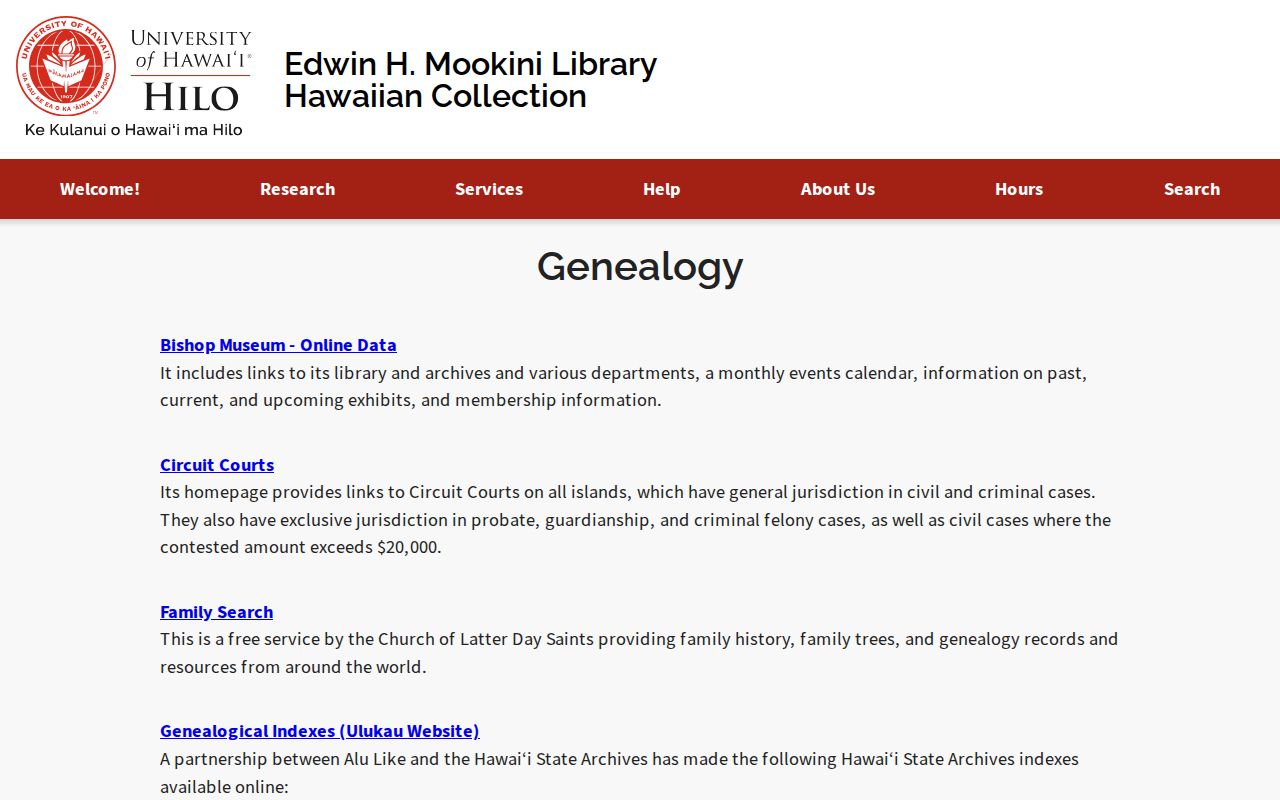
Use the directory page number, printed locality, name form, and date as citations, then compare the entry with maps, deeds, probate, or cemetery records.